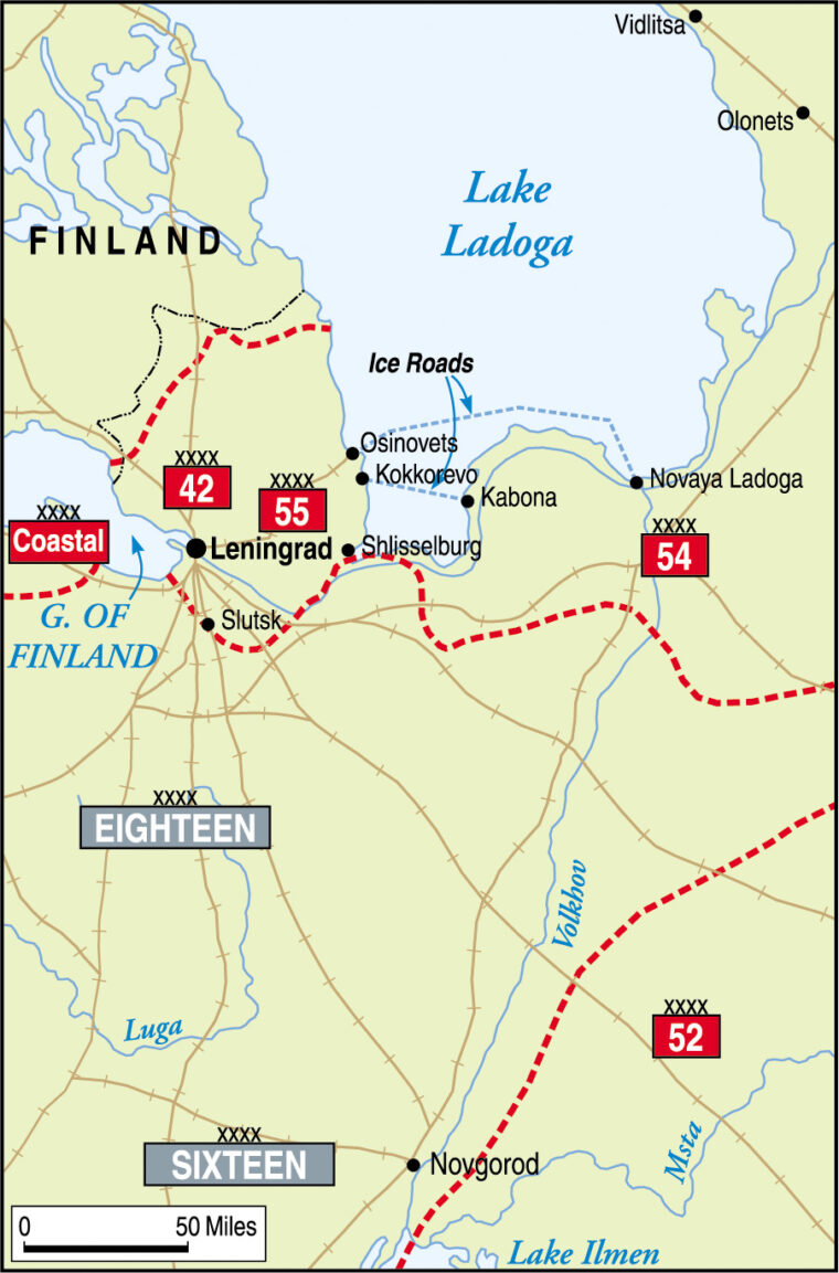
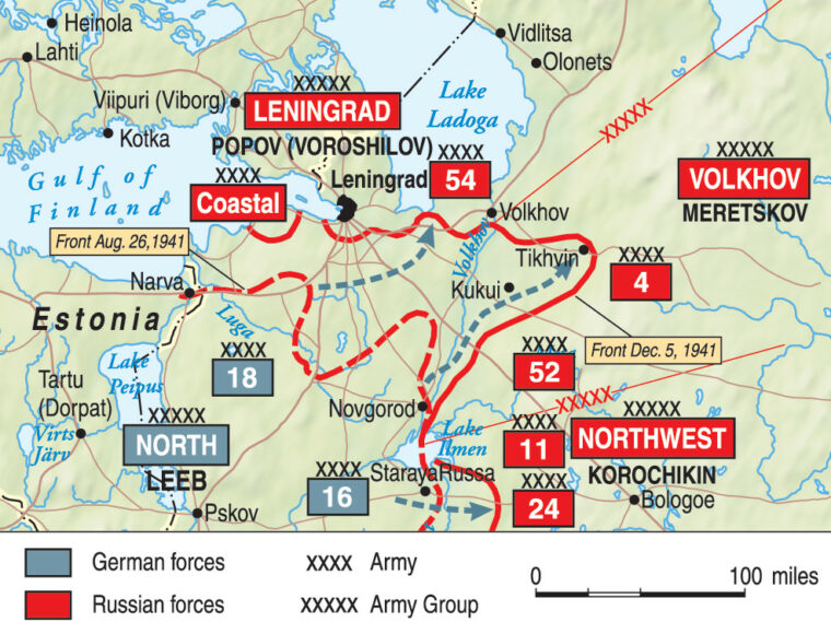
Alright, so I decided to tackle this Battle of Leningrad map. It’s been on my mind for a while, you know? Not like some grand academic project, just something I wanted to get my hands dirty with. I’ve always been fascinated by that period, and maps, well, they just tell a story, don't they?
First off, finding good base materials was a real headache. You'd think with all the information out there, it’d be easy. Nope. I spent a good few evenings just sifting through stuff. My initial checklist looked something like this:
- Find decent period maps: Easier said than done. Lots of them are low-res or have watermarks all over.
- Get a list of key locations: Factories, defensive lines, that sort of thing.
- Decide on the scope: Just the city? The whole pocket? I went for the broader area to show the encirclement.
Once I had some semblance of source material, I fired up my old graphics software. Nothing fancy, just the free stuff. I’m not made of money. Started by trying to trace the main geographical features – the Neva River, Lake Ladoga. That alone took ages, trying to get the curves looking somewhat natural and not like a kid’s drawing.

Then came the layers. Oh boy, layers. My first attempts were a mess. I had troop positions bleeding into city names, railway lines looking like spaghetti thrown at the screen. It was frustrating, I tell ya. I almost gave up a couple of times, thinking, "Why am I even doing this?"
The Whole "Road of Life" Thing
And then there was the Road of Life. Man, that part really got to me. It wasn't just drawing a line on a frozen lake. I started reading more personal accounts, diaries, stuff like that, just to get a feel for it. And suddenly, it wasn't just a supply route on a map anymore. It felt… heavy. I spent a whole weekend just trying to figure out how to represent it. Do I make it a solid line? Dashed? What color even? It sounds silly, but I got properly stuck on it. I even sketched out different versions on paper, trying to see what felt right. My missus came in, saw me staring at these scribbles, and asked if I was planning a new garden path. If only it were that simple! I realized trying to get it "perfect" was impossible, but I wanted to do it justice, you know? It’s a bit like that time I tried to fix the leaky tap in the bathroom. Thought it’d be a quick job, ended up flooding half the floor and calling a plumber anyway. Sometimes the simplest-looking things are the most complicated.
Back to the map itself. After the Road of Life detour, I focused on plotting the German and Finnish lines. This was tricky because they shifted, obviously. I decided to aim for a specific phase of the siege, otherwise, it would have been information overload. Even then, trying to get the front lines reasonably accurate based on grainy old maps and descriptions was a proper challenge. Lots of zooming in and out, comparing different sources, and a fair bit of educated guessing, if I'm honest.
Adding details like major industrial sites, airfields, and artillery positions came next. Each one felt like a small victory. I tried to keep the style consistent, which is harder than it sounds when you’re working on it piecemeal over several weeks. Some days I’d be really into it, other days I’d just stare at the screen and achieve nothing.
So, what’s the end result? Well, it’s not something you’d see in a museum, that’s for sure. It’s a bit rough around the edges. But it’s my map. I learned a ton, not just about the battle, but about how to (and how not to) go about a project like this. It’s satisfying to look at it and know every line, every label, I put that there. It’s a bit like that old shed I built in the garden – not perfectly square, but it stands, and it keeps the rain out. Good enough for me.


