So I got obsessed with figuring out where the Lighthouse of Alexandria really stood. You hear "Pharos Island," right? But coastlines change, cities drown… it’s messy. Needed to pin this down myself.
Starting with a fuzzy picture
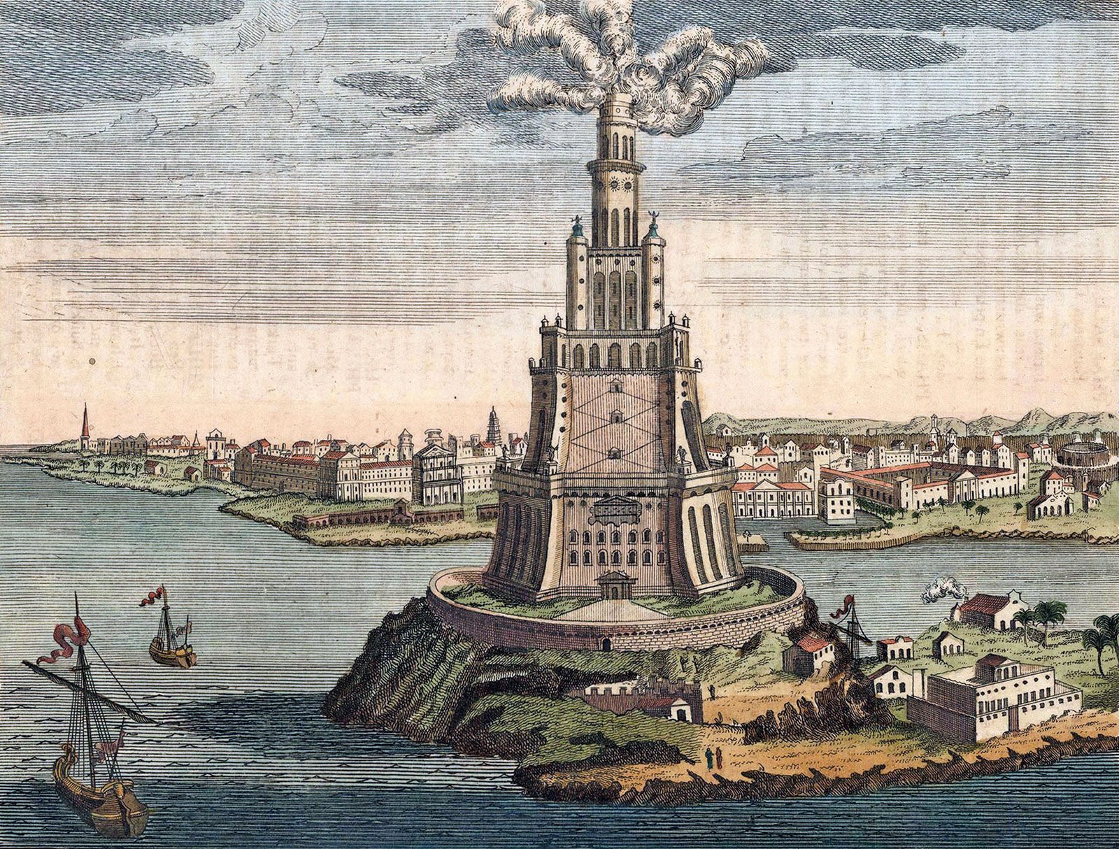
I pulled up every ancient map sketch I could find online. Most just slapped a big "X" vaguely near Alexandria. Frustrating! Like nobody bothered back then to be precise. Even written accounts were vague – "on the eastern side of Pharos," cool, but how far? Digging deeper turned into chaos:
- Stumbled on conflicting academic papers: One insisted the lighthouse was a kilometer offshore. Another swore it connected to the mainland via a causeway. Who to believe?
- Modern satellite images looked… different: That whole waterfront area today is nothing like the old sketches. Land got reshaped. Islands vanished underwater.
- Local dive blogs hinted at ruins: Divers near Qaitbay Citadel kept spotting giant stone blocks underwater. But were these lighthouse bits or just palace rubble?
My dive into geology
Archaeology wasn’t cutting it. I switched tactics to coastal geology stuff. Researched how Mediterranean sea levels rose over centuries and how earthquakes slammed Egypt. Turns out:
- Earthquakes are the big killer: Found records of massive quakes, especially in the 14th century. Could one have just shoved that massive lighthouse straight into the sea? Probably!
- Sediment buried the coast: The Nile dumped silt constantly. What might’ve been clear water between the mainland and Pharos Island could’ve silted up over time, merging things. Ancient geography didn’t stay frozen.
Connecting the dots underwater
The dive site evidence clicked then. Those huge stone blocks littering the sea floor by Qaitbay? Archaeologists confirmed they matched Ptolemaic-era construction – the lighthouse builders! This wasn’t random rubble. And crucially:
- Qaitbay Citadel sits right on top of older ruins: Think Lego blocks. Fort built on fort built on… probably lighthouse foundation remnants?
- Mapping the underwater stones: shows a massive "footprint," like something gigantic stood exactly where Qaitbay is today before collapsing seaward.
So here’s what hit me after days of this rabbit hole: The Lighthouse DID stand on Pharos Island. But thanks to rising water, earthquakes, and shifting land, that "island" part effectively got glued to the mainland centuries ago. The spot got built over, drowned, and rediscovered all in one go. Qaitbay stands on its ghost. Felt wild finally seeing the "moving" coastline history play out.


