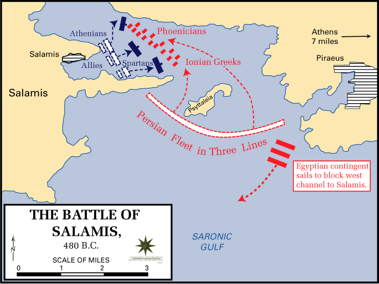
So, I had this itch, you know? To really get a handle on the Persian Wars. I figured, "Hey, I'll just make a map!" Sounded straightforward. I thought it would be a quick little project, help me visualize all those famous battles and troop movements. Turns out, it wasn't quite the walk in the park I imagined.
Getting Started (or Stumbling)
First off, I went online, looking for existing maps. And sure, there are tons. But none of them quite clicked for me. Some were too cluttered, others too simplistic. I wanted something that told the story, not just showed a bunch of dots and lines. I thought, "I can do better for my own understanding." Famous last words, right?
My first bright idea was to use some fancy mapping software. I’d seen people make cool-looking graphics, and I thought, "That's the ticket!" Spent a good couple of hours just trying to figure out the interface. It was like trying to fly a spaceship just to draw a line from Athens to Marathon. Talk about overkill. All those features, layers, projections – my head was spinning. I just wanted to see where Xerxes marched, not get a degree in cartography!
Back to Basics
After wrestling with that software, I pretty much gave up on the high-tech route. It was just too much hassle for what I wanted. So, I went old school. Grabbed a big sheet of paper, some colored pens, and my history book. Sometimes, the simple ways are the best, aren't they?
I started by just roughly sketching out the Aegean Sea and the surrounding lands. Greece, Asia Minor, the Hellespont – didn't have to be perfect, just recognizable. Then, I began plotting the main city-states. Athens, Sparta, Corinth on one side; Sardis, Susa on the Persian side. It was like putting together a puzzle, but first, I had to find all the pieces scattered across different book chapters.
Connecting the Dots
This is where it actually started to get interesting, and a bit messy. I decided to focus on the major campaigns.
- The Ionian Revolt – where did that kick off? Plotted those cities.
- Darius's first expedition, the one that got wrecked at Mount Athos. Tried to draw that route.
- Then, Marathon. That was a big one. Had to show the sea route, the landing.
- And of course, Xerxes's invasion. This was the monster. Tracing that massive army's path overland, the Hellespont crossing, Thermopylae, Artemisium, Salamis, Plataea. It really hits you, the sheer scale of it, when you’re trying to draw it all out.
I used different colors for different phases or for the opposing sides. Lots of arrows. My map wasn't going to win any design awards, let me tell you. It looked more like a general's messy battle plan than a polished atlas page. But that was kind of the point. It was my map, for my brain.
What I Ended Up With
The final "map" was, well, a piece of paper covered in lines, notes, and a fair few smudges. But you know what? It worked. For the first time, I felt like I really saw the flow of the wars. How one event led to another, how the geography shaped the campaigns. The long distances the Persians had to cover, the strategic chokepoints like Thermopylae – it all made so much more sense when I'd physically drawn it out, struggled with it.

I realized the actual act of making the map, even a messy one, was more valuable than just looking at a finished one. It forced me to engage with the material, to ask questions. "Why did they go this way?" "How long would that take?"
So yeah, my grand "map of the Persian Wars" isn't something I'd publish. It's a tool, a learning process. And honestly, it taught me more than just history. It taught me that sometimes the fancy tools aren't the answer, and getting your hands dirty, even with just pen and paper, is the way to go. I guess I know this now because I tried the complicated way first and it just left me frustrated. Sometimes, you just gotta simplify to understand.


